After waiting all day and most the night for that line of storms to drop down out of Indiana, I almost gave up on it as the line crossed the Ohio river around 4 am. The line had weakened significantly and lightning was becoming sparse at best. but to my suprise the southern edge of a dying bow segment re-initiated and became severe warned as it came into northern Fayette county. At 5:48 It became severe, I was watching from the front yard to the west as the sky flashed very frequently and even a few bolts managed to peek out from the side of the approaching storm.
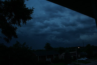
With daylight starting lightning shots were becoming more pointless as the sun had already turned the sky a dark blueish color and exposures were mostly washed out. there was enough light as the storm just passed to my north by 2 miles that structure shots became the priority. the following are a few of those shots.
Note, Trees were downed in Georgetown about 15-20 miles north of my location.

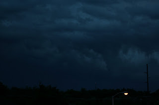
Not quite sure what the feature in the above shot is.. Funnel maybe or just weird vertical column of scud.. But i do know there was alot of motion to the rear of the cell


No comments:
Post a Comment