Friday, June 26, 2009

06-25/26 09 Storms

On the afternoon of the 25th intense lightning producing storms moved over the area.
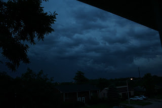
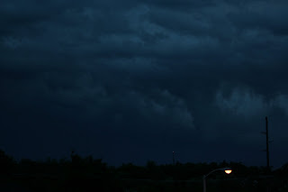
No warnings were issued but hail was reoported and winds cloese to 50-500 mph in places. And got a chance to use the new camera with a close storm that was cooperating with me.... The first storms were tornado warned as they were a few counties north of here, The rotation was still in progress as it came over our area as seen in the photo..


I do have video of the events as well as over an hours worth of audio .. the vid will be added to youtube later today...

Saturday, June 20, 2009

06-20-09 Early morning severe event

After waiting all day and most the night for that line of storms to drop down out of Indiana, I almost gave up on it as the line crossed the Ohio river around 4 am. The line had weakened significantly and lightning was becoming sparse at best. but to my suprise the southern edge of a dying bow segment re-initiated and became severe warned as it came into northern Fayette county. At 5:48 It became severe, I was watching from the front yard to the west as the sky flashed very frequently and even a few bolts managed to peek out from the side of the approaching storm.

With daylight starting lightning shots were becoming more pointless as the sun had already turned the sky a dark blueish color and exposures were mostly washed out. there was enough light as the storm just passed to my north by 2 miles that structure shots became the priority. the following are a few of those shots.

Note, Trees were downed in Georgetown about 15-20 miles north of my location.


Not quite sure what the feature in the above shot is.. Funnel maybe or just weird vertical column of scud.. But i do know there was alot of motion to the rear of the cell

Thursday, June 18, 2009

06-18-09 Severe Storms

A deracho that made its way from central IL into central Ky this morning brought with it extreme lightning, damaging winds and hail to the region. The fayette county area was mostly spared as the northern edge of the line hit southern Lexington, Winds reached 54 mph and a large rotating wall cloud and attendant funnels were observed over the man o war - tates creek road area


Wednesday, June 17, 2009

06-17-09 Close Severe Storms

With a warm front stalled across the area storms set up just to the south of the Lexington area. Again tornado warnings south in the Garrard county Pulaski county areas, Wall cloud was seen approx 10 miles south of my location, other persons photographed a funnel out of this same wall later on after it left our sight.


Tuesday, June 16, 2009

06-16-09 Tornado BUST

Headed south to lincoln county to try and get ahead of the apex of a large Bow Echo.
Since we had to be back in Lexington by 6:30 we couldnt head as far south as we wanted and ended up missing out on the tornado that developed about 30 or so miles south of our location on the other side of the rain that overtook our location in Stanford Ky. On the way back we did run into a torrential downpour and almost watch a semi hit some cars....


Wednesday, June 10, 2009

06-10-09 Shelf Cloud

The afternoon of the 10th a storm moved into the fayette county area with an impressive triple layer shelf. the storm weakend as it passed over us but it was still a great looking storm at first.


Wednesday, June 03, 2009

06-03-09 Borderline Severe

On this date pop up cells started late in the afternoon just before sunset. at one point we were surrounded by 4 strong storms with nothing immediately overhead we observed what appeared to be a wall cloud at first with a hail core . then it appeared to develop a weak vortex underneath it. there was rotation within this and the updraft above it. that lasted about 5 minutes or so then the light show began as the storms moved on to the north and east...