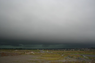
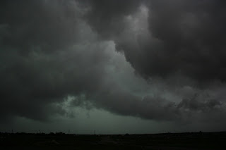
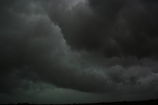
Thunderstorms rolled across the area today bringing damaging winds and heavy rains along with very intense lightning. Around 245pm Severe thunderstorm warning was issued for Fayette county, By this time we were already set up at a great spotting location on the Fayette/Jessamine county line, At first the sky didn't look much different from any other storm but when the shelf cloud came into view we knew it was more than we expected. the shelf drew closer and we could make out significant lowerings behind it. Then off on the horizon we could see the advancing rain as more and more of the details of the horizon vanished. After the shelf rolled overhead, we observed what looked like a gravity wave about 2 miles behind the leading edge, this is the area that several funnels were seen, none became anything significant.
It was around this time a car pulls up behind us and out steps Bill Meck, WLEX Channel 18's Chief Meteorologist. (One of the best met's Turns out hes on vacation and had a chance to enjoy the storms in person rather than being in the studio during them. We chatted a few minutes and said our goodbyes as the precip started to reach us..
When the rain hit it came down hard and fast , within minutes streets were starting to flood over, As we headed back for the house bri decided to check something out near his house and WOW, looked like a small waterfall pouring out from behind his yard, water was a few inches deep about 10 ft wide and was moving very fast.
Probably due to a storm drain back there being clogged.
Power outages, Flooded and closed roads and tons of lightning strikes were common around the Lexington area this afternoon... with the front hanging around the region well just have to wait and see what we get tomorrow....
Until next time


1.5 inches of rain in less than an hour caused excessive runoff issues across the county

Radar @ 2:55 Pm

Base Velocity Radar @ 2:55Pm

Radar @ 3:14 Pm


